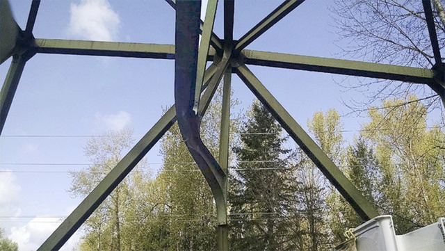
After months of planning and preparation – by both the state and the motoring public – the Department of Transportation is about to launch its week-long closure of the White River bridge.
The travel obstacle, which will prohibit the usually-easy jaunt between Enumclaw and Buckley, should come as no surprise. There has been plenty of publicity and signs have been posted on each side of the river for a couple of weeks, at least.
But for those who missed it, the bridge – traveled by an estimated 20,000 vehicles per day – will be off-limits beginning at 10 p.m. Friday, April 15. It will be closed to drivers, walkers and bicyclists until reopening at noon on Saturday, April 23.
The big question remaining is how to get around the repair work, to travel between King and Pierce counties. Plenty of commuters make the trek each weekday, as evidenced by the long lines of southbound vehicles that back up at the Park Street traffic light in Buckley and blanket state Route 410 well into Enumclaw.
The Courier-Herald staff traveled a few alternatives, taking into account time, distance and ease of travel.
• First, the official detour route. The DOT website suggests using SR 410, SR 164, Highway 18 SR 164. Most drivers are familiar with all those busy roadways. Driving time will largely be dependent upon 164 traffic. It’s clearly the most distant of the possible routes, at least from the Plateau, but they’re well-traveled roadways that allow for heavy volume – and they get it.
• Most drivers familiar with the Plateau area know how to skirt around the east side of Lake Tapps and slice substantial miles from their trip. For the uninitiated, here’s the scoop: from SR 410 in Bonney Lake, turn north onto 214th Avenue; drive north/northeast for less than 10 miles, to the stop light at the North Tapps Place shopping area. Turn right at the light and make the downhill trip to Game Farm Park in Auburn. Immediately after the park, turn right on Riverwalk Drive and, in a couple of minutes, turn right onto SR 164. The highway journey lasts perhaps 15 minutes, depending on traffic, and delivers drivers to Enumclaw City Hall at Porter Avenue.
• But what about those in the valley? One option is to get on SR 410 and take the 166th exit, just before Elhi Hill. Starting in the shadow of the 410 overpass, the climb onto the Plateau doesn’t take long – after four minutes and 1.8 miles, drivers will pass South Drive East; a minute later, pass through the traffic light at West Tapps Drive. At 16th, turn right and travel 3.5 miles to North Tapps Place. From there, head toward Auburn and the time and distance is the same as above.
• Another option from Sumner is to take East Valley Highway north, then exit and climb the hill to Lakeland Hills. Once at the top, it’s a little more than a mile on Lake Tapps Parkway to the intersection at North Tapps Place; take a left and follow the same path as above – to Game Farm Park, up Riverwalk and – when staring at the entry to the Muckleshoot Casino – turn right onto SR 164.


