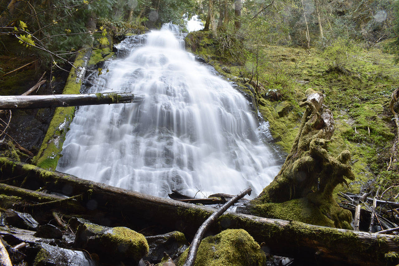
In 75 minutes, you could be standing underneath this waterfall.
Of course, I’m making a few assumptions: 1. You live or work in or near Enumclaw. 2. You have access to a vehicle. 3. You can handle a mile of strenuous hiking.
I often delude myself into thinking I won’t have time for outdoor recreation. But life is short and the peak season to galavant around Mt. Rainier is nearly upon us. If you’re prone to laziness like me, knowing the precise time it takes to get outdoors might help snap you out of your excuses.
After a 30 minute drive from the Courier-Herald to the trailhead, I hiked for another 45 leisurely minutes before reaching the falls. From there, hours more of hiking were within my reach.
This is the Palisades Trail, appropriately named for the sheer cliffs along which the trail runs. Starting from Chinook Pass Highway, it’s a strenuous but not overly difficult trek that serves up a lot of great views within its first two miles.
You can experience a lot here in just three hours, from roaring falls to old and new-growth forest and sweeping views of the landscape below.
The trailhead and small parking area is just past the Skookum Falls Viewpoint on your left, if you’re coming down 410 South. Be aware that your vehicle may feel a little exposed to the highway. You’ll want to take valuables with you.
Guides online differ on whether you need a pass to park there, so I called the Forest Service and asked. The answer is no, a spokesperson told me: There is no pass or fee required to park at the trailhead.
If you’re following maps on your phone, be sure to look for the “Palisades Trailhead,” not the “Palisades Trail;” the latter will put you on a forest service road about ¼ of a mile before the actual trailhead.
The trail is well-maintained, and the traffic was light-to-medium when I visited in mid-May. I met a few nice folks every half-hour or so, but otherwise had silence and solitude – perfect!
The trail to the Lower Dalles Creek Falls is short and steep, hugging the walls of a steep ravine before giving way to switchbacks. Follow the signage to stay on the Palisades Trail as you go. The falls are accessible through a short spur from the main trail about one mile in.
If you’re aching to see the waterfall in all its glory, don’t delay. As snowpack melts, the falls will get weaker the farther we get into summer. If you intend to tackle more punishing or higher-elevation hikes this summer, this trail could be a good warm up.
From there, the trail throws more punishing elevation before yielding to beautiful, quiet, forest. You’ll find your only companions to be songbirds and the gentle creaking of fire-weakened trees.
This area, a sign at the trailhead informs you, has been subject to fires which have gutted or severely damaged some vegetation.
Nature’s wrath is on full display here, and you’ll catch a number of wicked-looking trees that look as though they’ve been struck apart, burned up inside or simply smote into the dirt. Always be alert and avoid hiking here if it’s very windy, lest your fate ends up much the same.
About 2 miles from the trailhead is a gorgeous view of the White River Valley, more than 1,000 feet below you. I stopped here, but the trail continues on to even better viewpoints and falls if you’re willing to get to them. Research a couple trail guides and maps before you leave to make sure you don’t miss them.
This time of year, the rivers and falls are still gushing from melting snowpack, so the trail is as gorgeous as it is treacherous. I encountered no snow on the trail before I turned around, but navigated plenty of wet rocks and muddy sections of trail.


